
unreachable.cloud
  • Communities
  • Create Post
  • Create Community
  • heart
    Support Lemmy
  • search
    Search
  • Login
  • Sign Up
beep@piefed.world to Technology@lemmy.worldEnglish ·
edit-2
5 days ago

MapQuest’s app surges to No. 1 in Navigation in the Apple App Store, after refusing to rename Lake Ontario

www.businesswire.com

external-link
message-square
33
link
fedilink
1
external-link

MapQuest’s app surges to No. 1 in Navigation in the Apple App Store, after refusing to rename Lake Ontario

www.businesswire.com

beep@piefed.world to Technology@lemmy.worldEnglish ·
edit-2
5 days ago
message-square
33
link
fedilink
Access Denied
www.businesswire.com
external-link

cross-posted from: https://piefed.world/c/tech/p/1371422/mapquests-app-surges-to-no-1-in-navigation-after-refusing-to-rename-lake-ontario
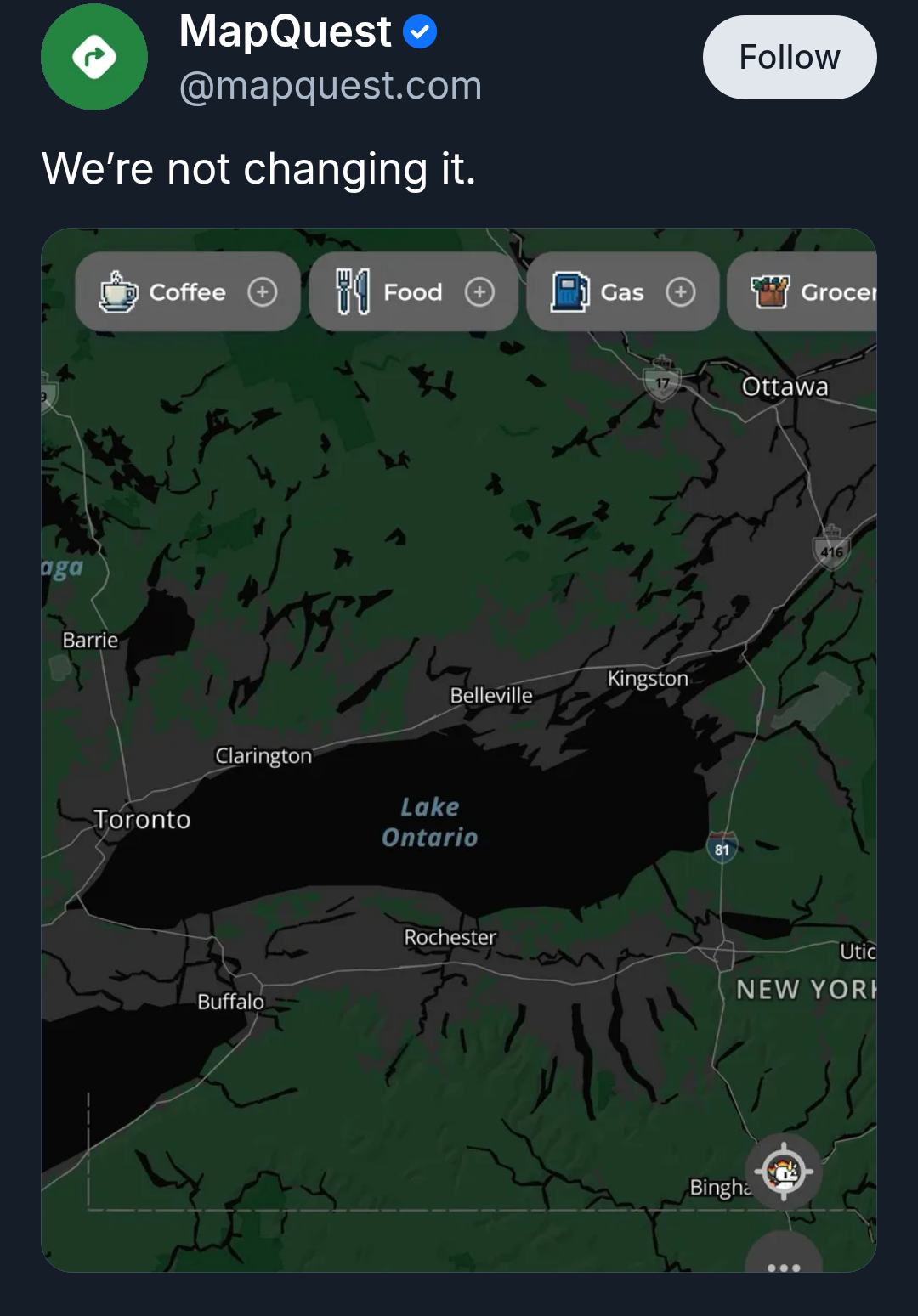
Source: MapQuest on Bluesky

MapQuest also released an online tool that lets you jokingly rename Lake Ontario to whatever you want it to be, then share the results on social media.

  • joostjakob@lemmy.world
    link
    fedilink
    English
    arrow-up
    0
    ·
    4 days ago

    OSM doesn’t really “pull” data. The vast majority is sourced by hand, and adding data from existing sources is a complicated process that requires a lot of preparation and cleaning up afterwards. So basically all of it is a community effort - and a single contributor can make a significant contribution to the project

    • potter2010@lemmy.ca
      link
      fedilink
      English
      arrow-up
      0
      ·
      edit-2
      3 days ago

      Maybe “pull” was the wrong word. However, looking at https://wiki.openstreetmap.org/wiki/History_of_OpenStreetMap I see:

      • 4th December 2006 – Yahoo! aerial imagery sketching allowed…
      • September 2007 – TIGER data import for the US started
      • 20th September 2007 – AND Data for The Netherlands imported
      • 1st April 2010 – Ordnance Survey Opendata releases.
      • 30th November 2010 – Use of Bing vertical aerial imagery allowed

      And on https://wiki.openstreetmap.org/wiki/Contributors it shows well over a hundred counties/regions with hundreds(?) of non-user data sources/sets that are used by OSM to maintain the map.

      Edit: clarity.

Technology@lemmy.world

technology@lemmy.world

Subscribe from Remote Instance

Create a post
You are not logged in. However you can subscribe from another Fediverse account, for example Lemmy or Mastodon. To do this, paste the following into the search field of your instance: [email protected]

This is a most excellent place for technology news and articles.


Our Rules


  1. Follow the lemmy.world rules.
  2. Only tech related news or articles.
  3. Be excellent to each other!
  4. Mod approved content bots can post up to 10 articles per day.
  5. Threads asking for personal tech support may be deleted.
  6. Politics threads may be removed.
  7. No memes allowed as posts, OK to post as comments.
  8. Only approved bots from the list below, this includes using AI responses and summaries. To ask if your bot can be added please contact a mod.
  9. Check for duplicates before posting, duplicates may be removed
  10. Accounts 7 days and younger will have their posts automatically removed.

Approved Bots


  • @[email protected]
  • @[email protected]
  • @[email protected]
  • @[email protected]
Visibility: Public
globe

This community can be federated to other instances and be posted/commented in by their users.

  • 406 users / day
  • 1.74K users / week
  • 1.89K users / month
  • 1.94K users / 6 months
  • 0 local subscribers
  • 87.8K subscribers
  • 354 Posts
  • 5.11K Comments
  • Modlog
  • mods:
  • L3s@lemmy.world
  • enu@lemmy.world
  • Technopagan@lemmy.world
  • L4sBot@lemmy.worldB
  • BE: 0.19.20
  • Modlog
  • Instances
  • Docs
  • Code
  • join-lemmy.org