

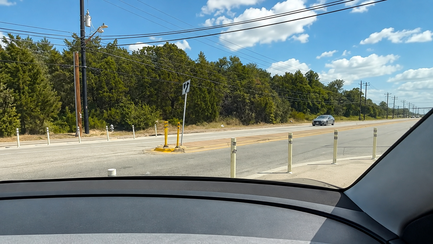
Take a look at this. A Tesla Robotaxi in Austin pauses, seems to reconsider a right-hand turn through some bollards, and then decides: “I’m just gonna send it.”
Take a look at this. A Tesla Robotaxi in Austin pauses, seems to reconsider a right-hand turn through some bollards, and then decides: “I’m just gonna send it.”
I wonder if it might also include outdated maps and this is newer infrastructure?
Still not an excuse, it should have seen it and not crossed the white line, but maybe it had conflicting info and chose wrong?
An automatic car should take into account any obstacle in the path whether or not it matches a map.
It did take the obstacles into account though at first. It was going very slowly and managed to squeeze itself into that bad spot, before ultimately realizing it was stuck and deciding to go over them once it had gone too far (I would love to know how the fuck it decided to do that last part though)
What it didn’t take into account from the start was the white line or bike lane sign, but those first bollards on their own it made it past.
If it had bad navigation data, that could have conceivably played a part, but bad map data seems less likely given there’s an image of that intersection from 2024.
Everything about this was still very bad obviously, but even if it wasn’t the case here, bad map data could get you into a bad situation like that if you can drive between the initial bollards.
Jesus Christ, it shouldn’t be squeezing through such a small gap in bollards on a fucking road. That should be a massive red flag that it is going the wrong way on top of the well marked white lines. If some random person did it we would be mocking them for being stupid no matter how well they kept from scratching the paint in the process.
It did a shit job the whole video. Stop making excuses for it.
Im not saying it should, and in this case and have clearly said what it did was wrong.
Im just trying to reason out how or why something like that may have happened, and at first bad map data seemed like it could be part of it wtf went wrong. (edit: even OP said they looked into it, implying they thought that might be a factor too!)
Road says go right. Oh shit its tight but I can make it. Im fucked. YOLO!!!
And yes, it shouldn’t have ignored the bicycle signage or the white line.
Have you never driven around a construction local traffic
roadonly sign that gets placed in the middle of the road or blocking a lane? AVs need to be able to do weird things like this, but in the correct situations, which this was not.…
???
I actually looked into that…!
The Google Maps interface lets you see when the street was imaged. It’s been that way since 2024, at least. A helpful Redditor shared the link to it.
https://maps.app.goo.gl/VZRjSc325Kg7Vpq17
I’m bad as an automotive journalist. What I lack in skill, I make up for with effort and comedic timing
Oh wow, that’s cool. I didn’t know they had date stamps on it like that. Definitely more than enough time to have updated the maps, especially since I believe Tesla uses data from google for navigation.